Prologue
This month we posted our 5000th cultural heritage model on Sketchfab. We consider this a major achievement. We did this in four years, based on projects in 10 countries. This is the work of three full-time team members and seven part-time staff in six countries.
As you will read below, our workflow is streamlined and fast. For example, in 10 days we documented 510 artifacts in the National Museum of Bosnia and Herzegovina with nearly 300,000 photos using five light boxes and turntables. We completed the processing in 30 days.
One month before, we scanned the complete Registan Complex in Samarkand, Uzbekistan in two days using four terrestrial scanners (323 scans): two FARO Focus S70s, one Leica RTC360, one Z+F 5016, plus 25,000 drone and terrestrial photos.
Below is an introduction to our organization, methods, workflow, and our vision for 3D cultural heritage.
Introduction to Global Digital Heritage
Global Digital Heritage (GDH) is a not-for-profit, private research and education organization dedicated to documenting, monitoring, and preserving our global cultural and natural heritage. We use digital visualization, 3D virtualization, geospatial informatics, and open access solutions to provide digital data and 3D models to governments, regional institutions, museums, local scholars, and the public. A key element of our mission is the democratization of science—we make all data freely available to the world in support of cultural heritage, heritage management, education, public access, scientific research, and to enhance the digital humanities.
We work towards these goals using virtualization technology to digitize entire collections, entire museums, and entire archaeological sites and landscapes. We create virtual repositories of specimens, museum collections, archaeological sites, and heritage landscapes that are available to any student, any child, any scientist or any enthusiast anywhere in the world. We create online analytical tools for education and research. Our virtual repository approach allows for the study and appreciation of places, monuments, and collections on a global scale, and provides a means to highlight the importance of those collections to a variety of communities.
We consider this an important enterprise. In the face of an increasingly hostile world, a global landscape where conflict, natural disaster, tourism, development, and climate change are destroying our shared cultural heritage at an accelerating rate, we provide 3D digital services to document and preserve places and specimens important to the global heritage community. In this context, we emphasize lesser known heritage, heritage at risk, world heritage sites in poorly funded regions, and little used museum collections. We do this for free. We then give copies of all the data and results to the host institution or regional/local authorities who can do anything they wish with the materials.
How did we get started?
Nearly 20 years ago I was leading a series of massive archaeological projects in the Arctic funded by the US National Science Foundation. One of the goals of these projects was using animal bones from ancient villages to reconstruct 5000 years of environmental history for fisheries, endangered species studies, climate change, and other topics. The problem was that there were few quality comparative collections in the world—how does one identify the individual bones of over 200 different birds, fish, and mammals? This led to the Virtual Repository of Arctic Zooarchaeology, a ten-year effort to put every bone of every arctic animal online in 3D with a searchable database and analytical tools. While it is not fully maintained and monitored at this time, the results of this project can be found here. A scientific publication on the project can also be reviewed.
Most of the scanning for this project was done prior to the development of sophisticated photogrammetry software. For this work we used a Konica Minolta Vivid 9i scanner and a FARO Edge Arm to capture the geometry, cleaned the models in Geomagic or Polyworks, and then added texture from 4-6 photos in ZBrush. This project was done at the Idaho Virtualization Laboratory (IVL) at Idaho State University when I was the Director of that lab.
In 2015, I moved to the University of South Florida where we set up a lab that included a number of 3D scanner specialists who had been doing buildings and large heritage sites for nearly a decade. With a large donation from a private foundation, we left academia in 2017, formed our own organization, and began projects in a number of countries. The expansion was rapid, even explosive. We began getting requests for projects around the world.
Equipment
- 2 FAROFocus3D S70 Laser Scanners
- 1 Z+F 5016 Laser Scanner
- 1 Leica RTC 360 Laser Scanner
- 1 Faro Edge Arm scanner
- 1 Faro FARO Design ScanArm 2.5C and 8-axis turntable
- 1 Artec Leo
- 1 Artec Spider
- 8 Sony cameras (aiii, aiv, ariv) and 20 lenses
- 2 Canon EOS 5D Mark IV cameras and 11 lenses
- 1 3.6m blimp
- 2 Insta360Pro 360 cameras
- 4 DJI Phantom IV Pro V2 drones
- 1 Trimble Geo7x GPS
- Numerous extension poles, tripods, foldio light boxes, turntables (including a 100kg capacity unit), ring lights, studio lights, and a suite of other equipment.
Our desktop processing computers generally have 128–256 GB RAM, 2080ti or 3090ti graphics cards, and 32 or 64 cores. Our laptops are equipped with 128 GB RAM, 8 cores, and RTX5000 graphics cards. For software we use FARO SCENE, Geomagic Wrap, ZBrush, Meshlab, CloudCompare, Metashape, Instant Meshes, and Artec Studio Professional. But our primary package for integrating everything is our 10 seats of RealityCapture software.
With this much equipment, logistics can be a challenge. Whether by airline, Land Rover, or donkey, we take what is needed to get the scanning completed.
Success and Future Needs
When we began this project, we imagined that the biggest problems we would face would be in data acquisition, modeling, and data storage. This turned out not to be the case. With the appropriate equipment, the correct software, and the availability of inexpensive disk storage, this was the easy part of the project. In fact, at this point in the project, we are storing nealy 150 TB of primary data and models.
The difficult parts of the project, and the needs that are not fully solved at this point, involve using the data and models. How do we serve 150 TB to the public, making all the data and models freely accessible? Serving the data is still problematic because using a cloud service such as Amazon or other hosts is financially prohibitive for a non-profit organization such as ours. But making the models freely available was solved by Sketchfab.
The ability to upload models quickly, add a portion of the metadata, and organize the models into collections worked perfectly for us as a first step to making the models accessible. But we are working on other tools as well. For example, all of our models are scaled, and when laser scanning is not utilized, we primarily use the scale system developed by Heinrich Mallison and sold under his Palaeo3D site.
But critical to our program is the ability to use these scaled models to conduct measurements and other analytical studies on the models. We are working to create our own system of conducting analyses. We are also increasing our database and search capability. Thus, our new website, to be launched in August of 2022, will have an entire suite of new analytical tools, but all of the models will still be served from Sketchfab.
Workflow
The GDH workflow is fairly simple. For artifacts, photogrammetry data are aligned in RealityCapture. Then a script processes 50 models at a time creating the mesh, cleaning, simplifying, and detecting markers. Then the markers are scaled by hand, any basic additional cleaning or simplification is done, and then another script unwraps, textures, and exports the .objs, 50 artifacts at a time. When laser scanner data are involved, these are processed in FARO SCENE or Leica Cyclone (when using multiple models of scanner). These are aligned and exported as e57 files, and then aligned with the photos in RealityCapture.
Occasionally an alignment simply does not work in RealityCapture, and for these specimens we use Metashape. If a model is extremely complex, needs special cleaning, needs sculpting, or other additional techniques, we use Geomagic Wrap, MeshLab, ZBrush and other software on an as-needed basis. It should be noted that we do very little post-processing of images except where absolutely necessary.
When processing data from the FARO Arm scanners, we use Geomagic Wrap, and for the Artec scanners, Artec Studio Professional.
Outreach and Education
Critical to our organization is empowering local authorities and communities with the ability to do their own documentation. For this reason we regularly do demonstrations, training, and seminars as needed by the stakeholders. This might include software training in RealityCapture, training on scanners and photography, or demonstrations of the potential of 3D applications in VR, AR, and other areas.
We regularly involve students as interns or in other activities. There is no classroom learning with GDH, all education is done in the field and in processing actual datasets.
Recent Activities
While one can scroll through a seemingly endless list of models on our Sketchfab page, it is perhaps best to visit our more than 60 project collections on Sketchfab.
But perhaps also interesting is our YouTube Channel where videos of some of our most important projects can be experienced, and where we highlight some of the most successful of our 3D adventures.
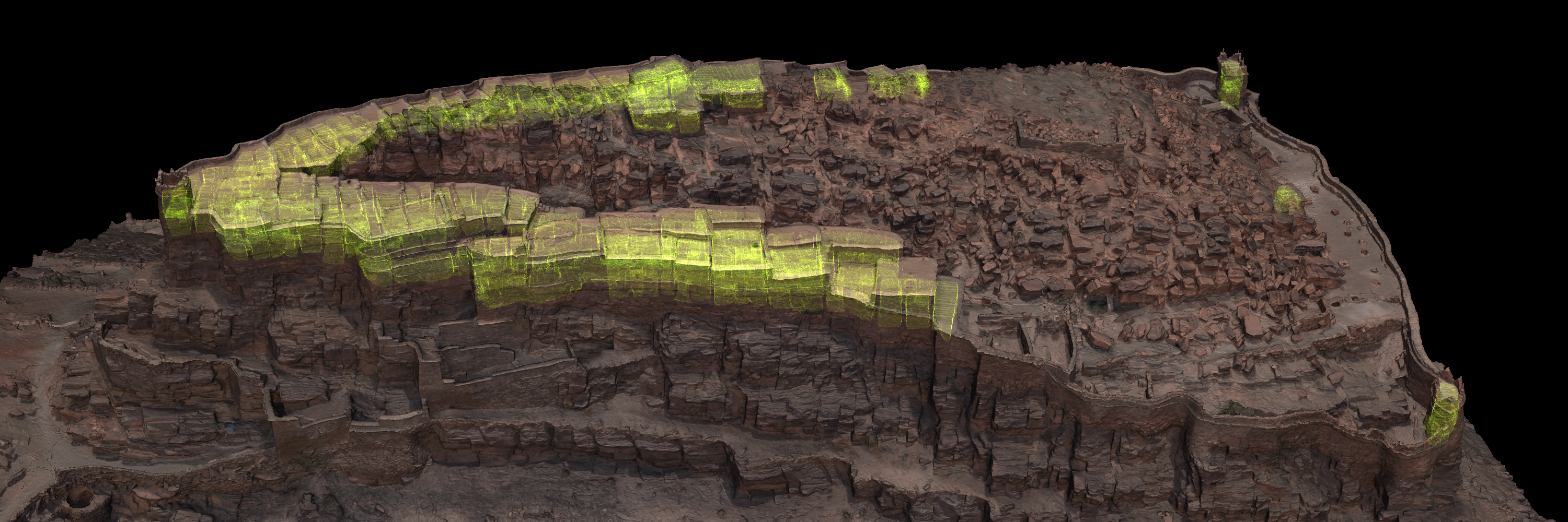
- Fortified Granaries of Southern Morocco
- Scanning Artifact Collections in Sharjah UAE
- Using DStretch in a 11th Century Church in Tuscany
- The gallery of the Natural History Museum in Paris
- The Roman Temple in Evora, Portugal
The Future
With the number of recent disasters involving the loss of complete museum collections, heritage buildings, and entire heritage landscapes, GDH will continue to emphasize basic documentation for conservation, education, preservation, and research.
But we are entering into other realms of digitization. Through collaborations with universities, museums, other 3D organizations, regional administrations, and national governments, we are developing new applications in virtual reality, augmented reality, museum experience, aerial LiDAR, aerial ground penetrating radar, and other techniques.
Elsewhere on Sketchfab
There are a number of super organizations and individuals that have wonderful collections on Sketchfab. One of our favorites, and an early inspiration for GDH, is the Zamani Project at the University of Capetown, South Africa. They have a great website and some excellent YouTube videos.
The work of Néstor F. Marqués throughout the Sketchfab community, as an individual, as 3D Stoa – Patrimonio y Tecnología, and as a creator for numerous museums, is excellent. Here is a great example from Spain.
We also appreciate the momentous work of noe-3d.at in Austria. Great models, and a massive amount of digitization.
Lastly, and a personal favorite of mine, are the educational traditional woodworking models of Uwood, in France. Here is a great example with animation:
Epilogue
We have a Canon 5D MkIV with nearly 2,000,000 photos on the shutter. We have taken more than 10 million photos in the last four years. In fact, two years ago in the Sharjah Emirate, we took 27,000 photos in one day. We have done 10,000s of scans. We have 3000 models waiting for the time to upload to Sketchfab. We are now funded for another five years of projects. We are proud of our history and optimistic for the future.
It has been a considerable amount of work. But yes, we have fun. We consider our jobs to be the best in the world. If you have ideas for super projects, if you are interested in collaboration, or you want to contribute to the goals of the project, send us your thoughts at gdh@globaldigitalheritage.org.


