Hop on board as we continue our journey Around the World in 80 Models! We began our itinerary at Sketchfab headquarters in New York and are working our way through Europe, Africa, Asia, Oceania, South America, and North America. To catch up on past destinations, check out the rest of the Around the World in 80 Models series.
This week we head north into Zimbabwe, where archaeologist Dr. Daniel Löwenborg gives us a tour of the Great Zimbabwe World Heritage Site and its associated features.
Great Zimbabwe, Zimbabwe: The Great Enclosure
The Great Zimbabwe site, in today’s south-central Zimbabwe, presents arguably the most unique architectural and dramatic cultural landscape in Sub-Saharan Africa. It is the largest of more than 300 dry stone-walled settlements scattered across southern Africa. Its monumental and magnificent walls that incorporated natural granite boulders, the wealth of gold, copper, iron, soapstone artworks, as well as imported ceramics and beads reflect the political, religious and economic importance of the site during its fluorescence period during the mid-second millennium AD. With its immediate hinterland, Great Zimbabwe was home to an estimated 20 000 inhabitants at its apogee who were drawn deep into the Indian Ocean trade via the Swahili coast, trading gold, ivory and royal animal skins for clothes, beads, imported ceramics and trinkets. Social networks were established between this city and its countryside, its farmers and specialist craft producers within complex connections and disconnections with other parts of the world.
Because of its significance as perhaps the most important historical and cultural symbol of African identity in Southern Africa (Ndoro 2001), but also its architectural magnificence, Great Zimbabwe was designated first as a National Monument during the colonial period and eventually UNESCO’s World Heritage Site in 1986 under the following 3 criteria:
- Represent a masterpiece of human creative genius. The great ancient city has struck the imagination of African and European travellers since the Middle Ages as evidenced by the persistent legends which attribute it to a Biblical origin.
- Bear a unique or at least exceptional testimony to the cultural tradition or to a civilization which is living or which has disappeared. Great Zimbabwe bears a unique testimony to the by-gone Shona ancestors who dominated southern Africa between the 11th and 16th AD Centuries.
- Be directly or tangibly associated with events or living traditions, with ideas, or with beliefs, with artistic and literary works of outstanding universal value. The entire Zimbabwe nation has identified with this historically symbolic ensemble and has adopted as its emblem, the steatite bird, which may have been a royal totem. In 1980, the site gave its name the country, Zimbabwe i.e. large houses of stones, as it emerged from almost a century of protracted struggles against British colonialism and domination.
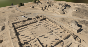
Great Zimbabwe divides into four major architectural zones namely the Hill Complex, Great Enclosure, Valley Ruins and Peripheral Settlements.

The Hill Complex
The Hill complex sits on one of the highest, most precipitous and rocky granite hills that characterize Great Zimbabwe’s undulating landscape. It therefore enjoys a cultural and natural dominance over its surroundings. Its southern wall sits precariously on the edge of a precipice, striking a deep sense of awe in the beholder as it showcase a feat of ancient architectural engineering by the ancient masons. Its massive western wall, mounted with turrets and monoliths, compounds the enigmatic outlook of Great Zimbabwe. The Hill Complex has numerous enclosures, created from the skilful incorporation of natural granite boulders into the dry stone wall fabric, an art that gave the symbiotic aura of the Hill complex landscape.
The Great Enclosure
The Great Enclosure, which is situated across the valley on the southern end of World Heritage Site, is arguably the most spectacular and grandeur edifice. According to southern African archaeologists (Garlake 1973; Summers 1971; Hall 1987; Ndoro 2001), its outer perimeter wall of approximately 252m in length and a maximum height of 11 metres and thickness of 7m at the base make the Great Enclosure by far the largest single prehistoric structure in Sub-Saharan Africa. Like the Hill Complex, it contains numerous internal enclosures, pole and mud house foundations and the famous Conical Tower. The tower is flanked by two michechete trees, whose age spans hundreds of years. According to Shona culture, the Conical Tower symbolizes a gigantic grain storage silo which in signifies human and land fertility as well as food security. Besides showcasing tremendous improvements in dry-stone walling workmanship, the Great Enclosure boasts of the most elaborate double-chevron decoration at the back of the giant circular wall which is mounted with numerous stone monoliths. Although most of its entrances are opened, archaeologically research established that these were originally lintelled with wood (Matenga 1996).
-
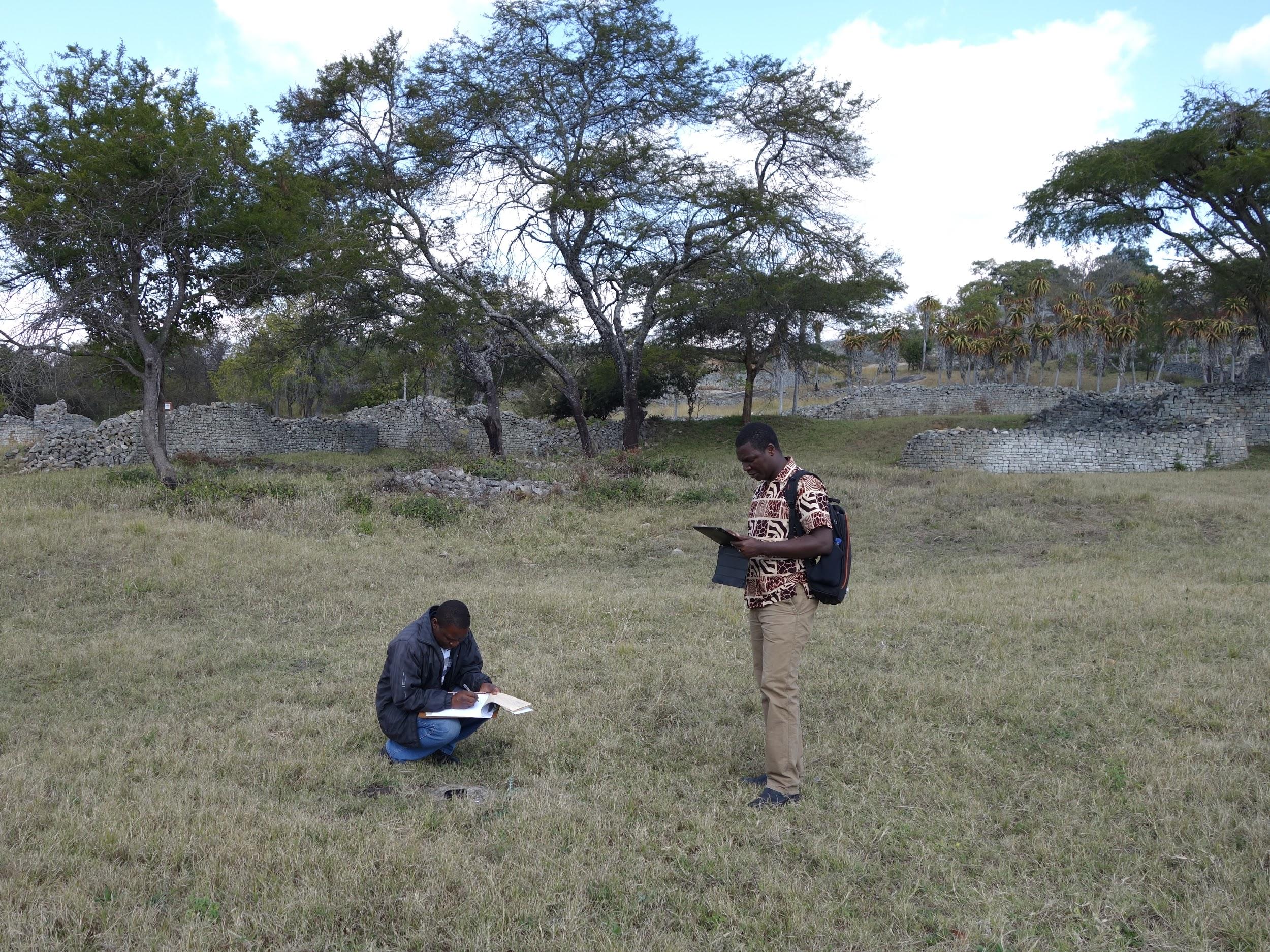
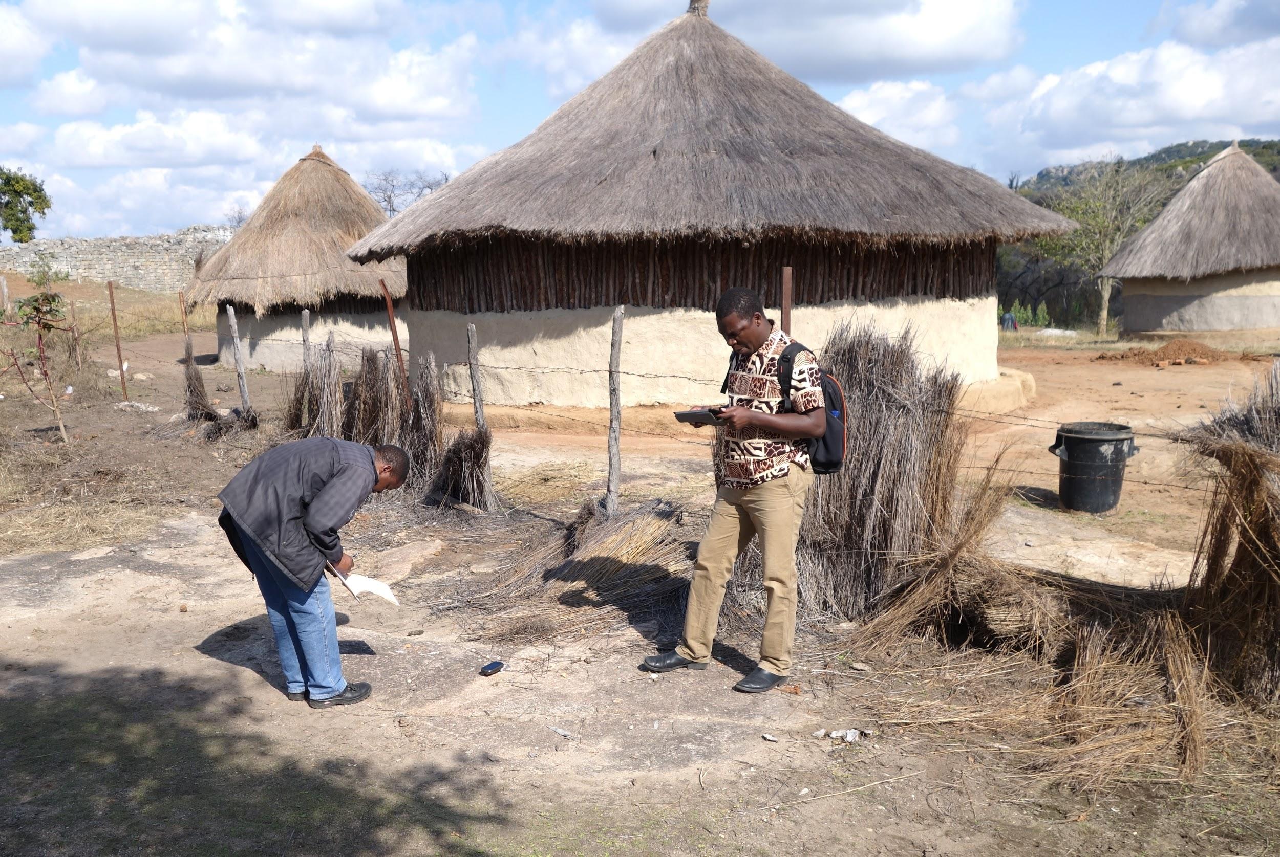
- Capturing ground control points with a hand held GPS reciver to improve the spatial accuracy of the model.
-
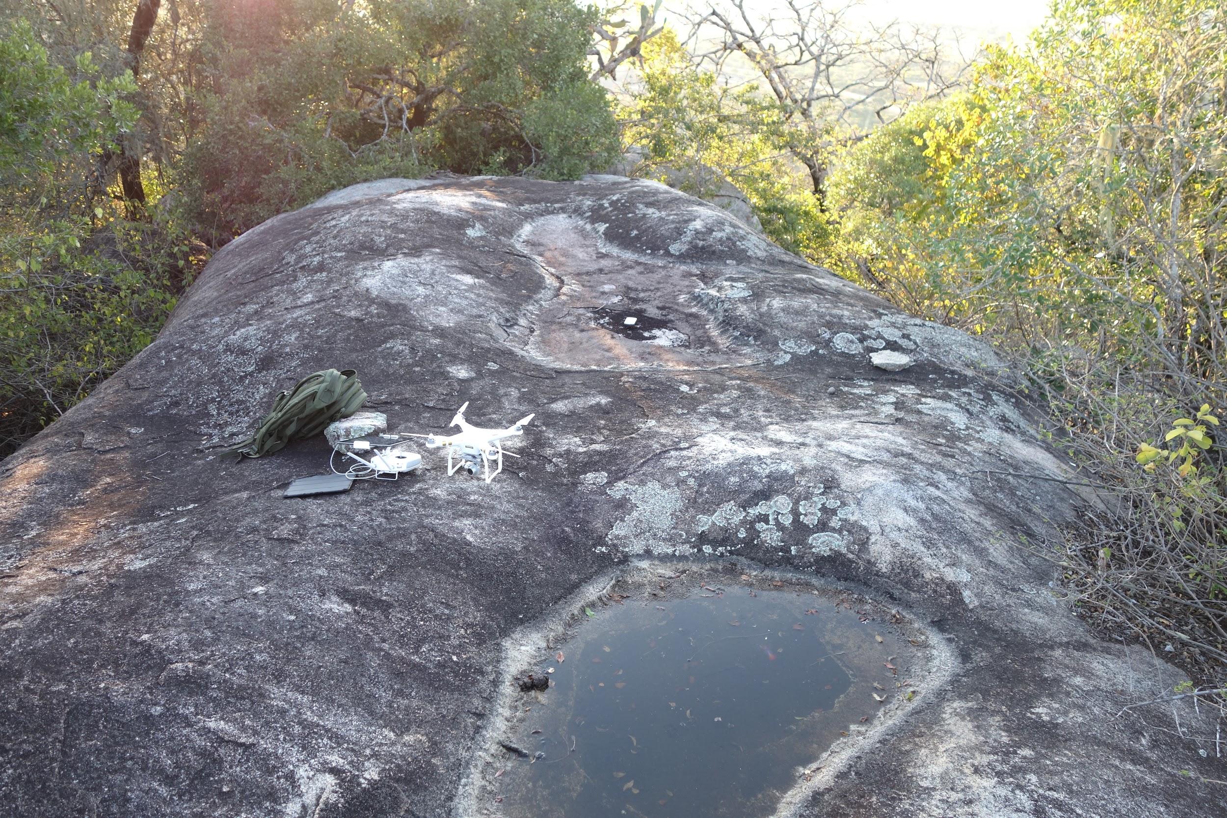
- The Phantom 3 getting ready for take off from a peak of the Hill complex.
About the Survey
In July 2016 the Great Zimbabwe heritage site were surveyed using a DJI Phantom 3 system to generate 3D models, orthophotos and elevation models for the research project Ancient Great Zimbabwe’s Iron Industry -an archaeometallurgical view of social complexity by Ezekia Mtetwa from Uppsala University, Sweden. The survey was conducted in collaboration with Dr Daniel Löwenborg, Uppsala University, and Justin Magadizike from the Surveyor and Monuments Inspector of National Museums and Monuments of Zimbabwe (NMMZ). The generous support obtained from Mr Lovemore Mandima, the Regional Director of NMMZ’s Southern Region Division, Mr Darlington Munyikwa, the Deputy Executive Director of NMMZ who granted the research permit on behalf of Dr Godfrey Mahachi, the Executive Director of NMMZ -who was outside the country at the time, is highly appreciated. All this work was made possible through a generous financial support from the Societas Archaeologica Upsaliensis research grant. During one week of surveying, a number of flights were done to capture both the site as a whole, and some of the more important monuments. In addition a number of archaeological sites connected to the research project in the surrounding landscape were documented.
For the monuments, images were captured manually with the Phantom 3, to make sure that all angles were covered, since they present complex geomtrical structures that are partially covered by trees. The models where processed in Agisoft Photoscan, where images were edited to remove as much as possible of the vegetation and produce clear textures for the walls.
For the larger models, like the Great Zimbabwe Valley an automated approach to capturing images were chosen. Pre-programmed flight paths were generated with the Map Pilot app, that uploaded a route of GPS points to the UAS, with information about altitude and speed of flight so that images were captured to achive the right overlap. The 860 images for large valley model was captured during two days of flying since we were limited in time to the 5 batteries available. A model of 120 hectares of the area were created with the program Pix4Dmapper Pro.
To see more of Daniel’s models here on Sketchfab, check out his profile!
About the author
Abby & Néstor
Abby and Néstor are Sketchfab Masters.
Abby Crawford, Ph.D. is trained in and passionate about Roman Archaeology and works as a freelance artifact illustrator and 3D scanner in California.
Néstor F. Marqués is a virtual Heritage & cultural diffusion researcher, and an enthusiast of ancient Rome’s culture.