About Me
My name is Pablo Romero Pellitero, I’m an archaeologist and, since 2014, I’ve been working at the MEMOLab Laboratory (Biocultural Archaeology Lab from the University of Granada). I’m responsible for the 2D and 3D documentation record for archaeological excavation and survey. I also manage the laboratory’s official Sketchfab profile.
I have a degree in History from the University of Malaga and an MA in Arabic and Hebrew Cultures from the University of Granada. I specialized in Geographic Information Systems and digital technologies of graphic documentation, as well as topography applied to Heritage. I have completed my training in the application of LiDAR systems for the study of cultural landscapes. I also have experience in virtual reconstruction of heritage and development of outreach materials. In 2012 I started working with 3D for cultural heritage in several European and national projects, on archaeological excavations and surveys where the MEMOLab team developed 3D recording methodologies.
Why I Use 3D Content In My Current Work
Andrea Carandini affirmed that an archaeological excavation “is like burning the pages of the only existing copy of a book immediately after its reading” (Carandini, 1997). Hence, as a scientific discipline, we have sought to improve our information recording methods, so that we sacrifice as little information—both in terms of quantity and quality—as possible in the course of archaeological interventions.
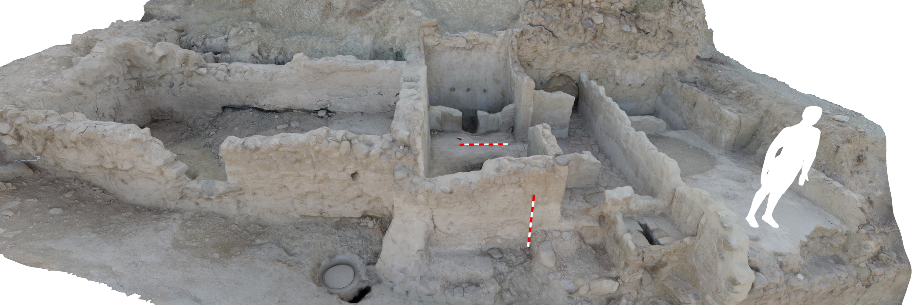
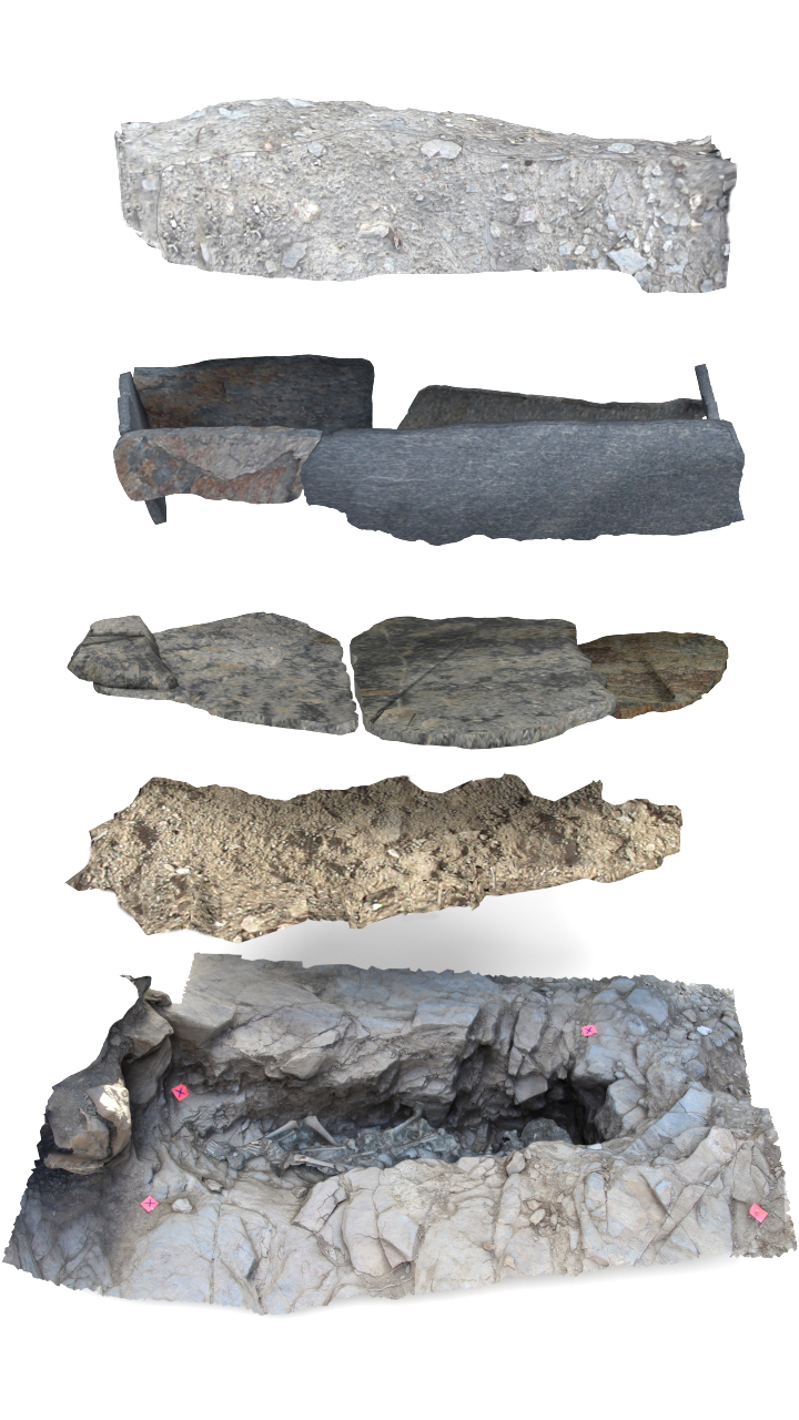
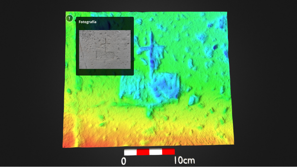
The main approach from the outset of the intervention at the site is to document it in full digitally, especially the stratigraphic sequence. By doing this, the excavation process will be virtually reversible, by digitally reproducing all the phases of the process. This methodology is really interesting due to the possibilities it provides for research and continuing analysis of the results.
Workflow
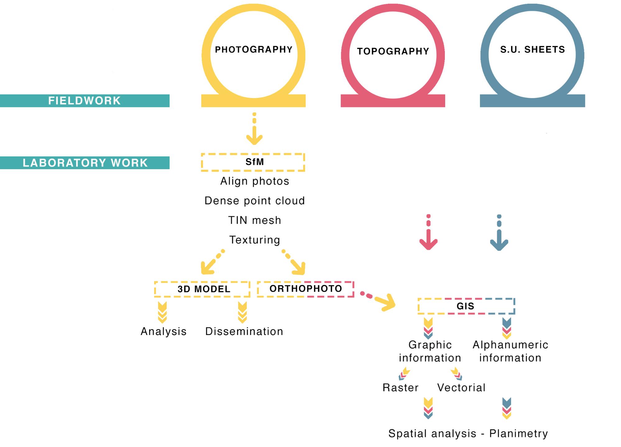
The work is structured in two main phases: fieldwork focused on obtaining data, and a research work phase focused on processing such data to obtain results susceptible of analysis that aids the historical-archaeological study.
Fieldwork
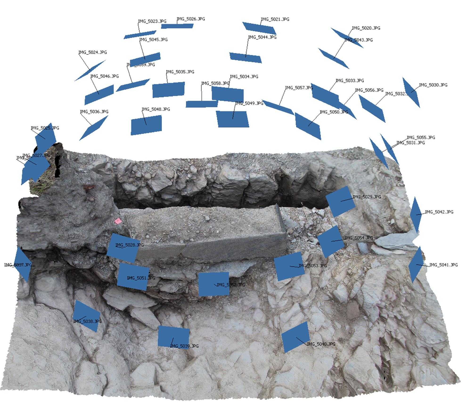
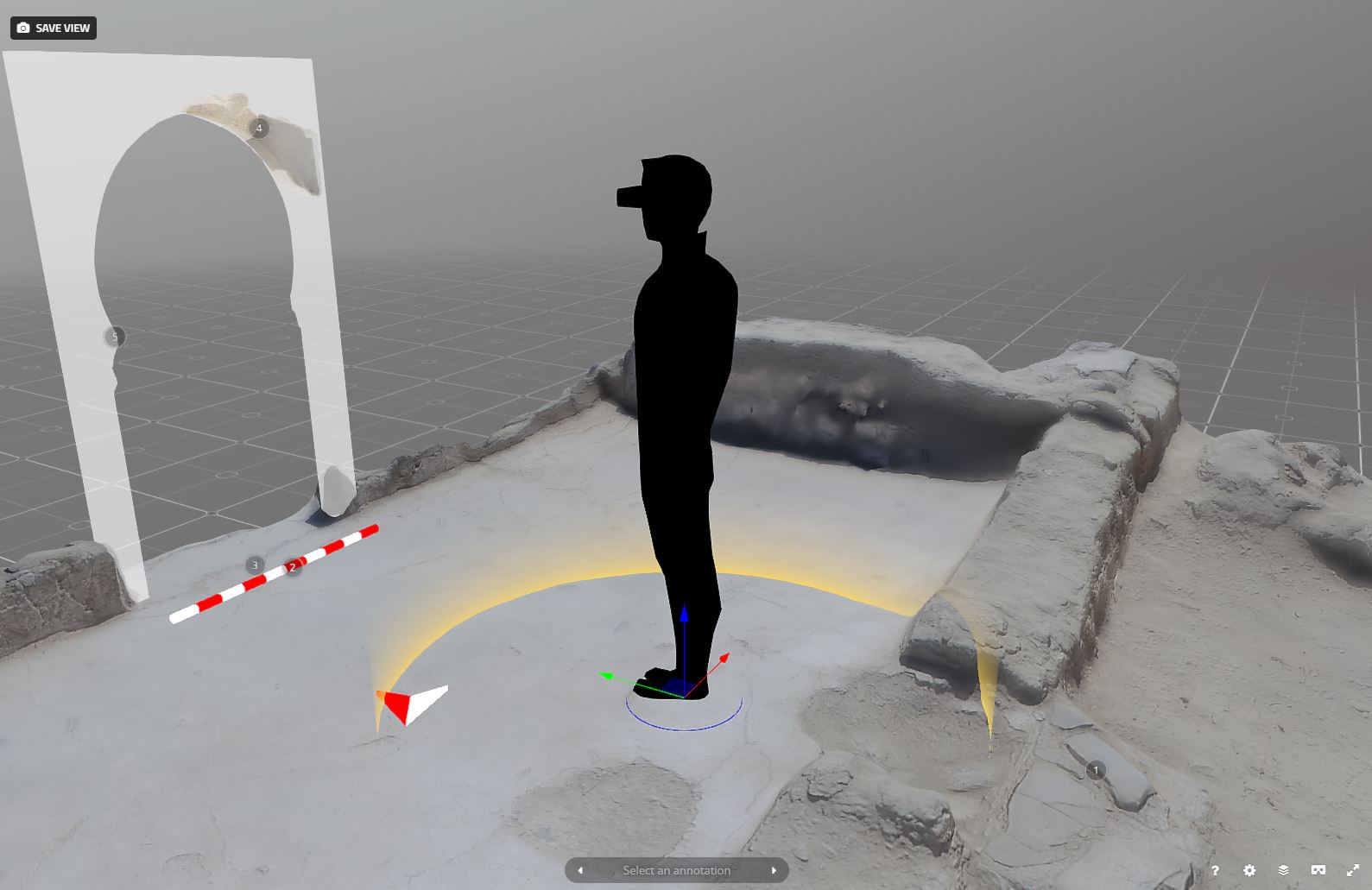
The digital image is the main element in this workflow, so site excavation requires a photography capture protocol focused on 3D modelling. The record consists of an exhaustive photographic recording of each Stratigraphic Unit (SU), which, in our case, is the basic unit of documentation. This system conforms perfectly to the guidelines of an archaeological excavation with the stratigraphic methodology.
Once we have a fully delimited SU (or several of them) on the surface, we move on to the preliminary documentation prior to its (or their) removal in search of the underlying SU. The number of photographs will be determined by the features of the SU, including its dimensions, typology (filling of earthy matrix, collapse of building materials, walls, etc.) and external factors, such as changing lighting throughout the day, parts of the same SU documented at different times and/or years, etc.
It would be inconceivable to implement this methodology without topographic support. This allows us to georeference the work, bring great precision to the 3D model, connect different SUs, relate successive excavation campaigns, etc.
Laboratory Work
Once we have documented an SU on the site and completed its excavation, we move on to the laboratory work phase. The first step is based on the use of Structure from Motion (SfM) software to produce volumetric models from 2D images. Nowadays, the implementation of SfM represents a great advance in the use of photogrammetry within the workflow of an increasing number of archaeological projects. Starting from a set of images with a high degree of overlap between them, we aligned and oriented the photographs and then generated point clouds. The generation of a mesh using this point cloud is the next step in data processing.
The final phase of the work with the image processing and 3D model generation software is to produce an orthophoto in the chosen coordinate system. In this case, the result of 3D photogrammetry is quite an advance compared to 2D because it is free of any perspective error.
The other fundamental pillar of this comprehensive documentation system is the integration of alphanumeric and geometric information through the use of a Geographic Information Systems (GIS). The result is a more complete and complex record, which enables us to carry out an in-depth analysis of the archaeological site in the laboratory.
These types of recording techniques, compared to more traditional techniques, allow us to reduce the time we spend on large-scale data collection. In the last year I have made about three hundred 3D models, and for this I have also used an unmanned aerial vehicle (UAV) to register large areas.
Sketchfab
These techniques have also proven to have enormous potential for dissemination tasks. We normally limit scientific documentation to our professional field, so we use a coded language that can be complex for the public to understand. The rendering of three-dimensional models of the different stratigraphic units and archaeological objects has a great informative and educational value, for example if we carry out volumetric reconstructions of the stratigraphic sequence excavated.
The new forms of communication that have emerged are effective tools to move forward in disseminating and communicating archaeological discoveries. The main route taken for this work has been Sketchfab, a social network specialised in 3D models. Sketchfab allows for a better dissemination of scientific knowledge and a greater impact on our discipline from a social point of view. This change should signal greater and better protection and conservation of heritage, especially of non-monumental or artistic heritage, whose values reside in their capacity to generate historical knowledge.
In 2017 my colleague Delgado Anés and I participated in the First Public Archaeology Twitter Conference. We presented the Archaeological record in 3D through Sketchfab from the archaeological excavation “Pago del Jarafi” (Lanteira, Spain). We focused on the importance of Sketchfab’s social network for academics to facilitate a more interactive and two-way communication with the wider public, as well as to get feedback from academic colleagues. This approach allows us to communicate faster than with traditional print media and our work is more transparent.
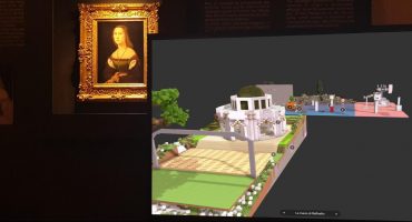
The improvements in 3D settings by Sketchfab—customizations such as annotations, sound, and virtual reality—help us to present models more completely and didactically. In my opinion, Sketchfab is a useful tool to create virtual exhibitions, specially when the researchers or administrations don’t have economic support to develop them. It is also a great tool to reach members of the public who cannot visit the archaeological sites and locations of cultural heritage. Sketchfab also has a lot of didactic potential; professors can use with it with high school students to teach about e-skills and cultural heritage. In fact, we used Sketchfab to display models of cultural landscapes with traditional irrigation systems made by teenagers using Minecraft.
Favorite Projects on Sketchfab
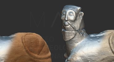
On Sketchfab we can find excellent works related to archaeological and architectural heritage, such as the cases of the Real Fábrica and the Arc of Triumph in Palmyra. The digitizations allow us to preserve and to know this heritage.
Content on Sketchfab also highlights how masterpieces of painting can be represented in 3D.
To learn more about my work: Academia.edu / Twitter / ResearchGate
For more information:
Delgado-Anés, L.; Romero Pellitero, P.; Richardson, L.J. Virtual archaeology through social networks. The case of the I Public Archaeology Twitter Conference. En: Rodríguez Ortega, N. (ed.). III Congreso de la Sociedad Internacional Humanidades Digitales Hispánicas: Sociedades, políticas, saberes. Málaga: Sociedad Internacional Humanidades Digitales Hispánicas, 2017. pp. 293-298. [http://hdl.handle.net/10481/47904]
Romero Pellitero, P., Delgado Anés, L., & Martín Civantos, J. M. (2018). Digital Public Mortuary Archaeology via 3D Modelling: The Pago del Jarafi Cemetery (Granada, Spain). AP: Online Journal in Public Archaeology, 8(2), 195-220.
Romero Pellitero, P. & Martín Civantos, J.M (2017). From 3D to GIS. A comprehensive methodology for recording stratigraphy and its application in the MEMOLA Project. DISEGNARECON, 10(19), 2-1.
