About
Hi, we are Alessandro Monti and Federico Risi from Skycrab, an Italian company that deals with photogrammetry with drones. We both started to work with this technology during our master’s degrees a few years ago.
Federico, who studied architecture in Milan, worked on a project to recreate a famous ancient village in Italy located in an old valley in the province of Bergamo in order to show the potentialities of photogrammetry to study architectural conservation plans.
Alessandro studied Nature Management in Copenhagen, and he conducted a research project to create a 3D model of an Italian regional park as a tool to better organize the placement of the operator of the Park to perform a census of the population of ungulates.
After our University experiences we started to collaborate on Skycrab together with Carlo Facchetti (commercial pilot), where we provide services related to photogrammetry survey and teach courses about Agisoft Metashape, the software that we use for our works.
The project
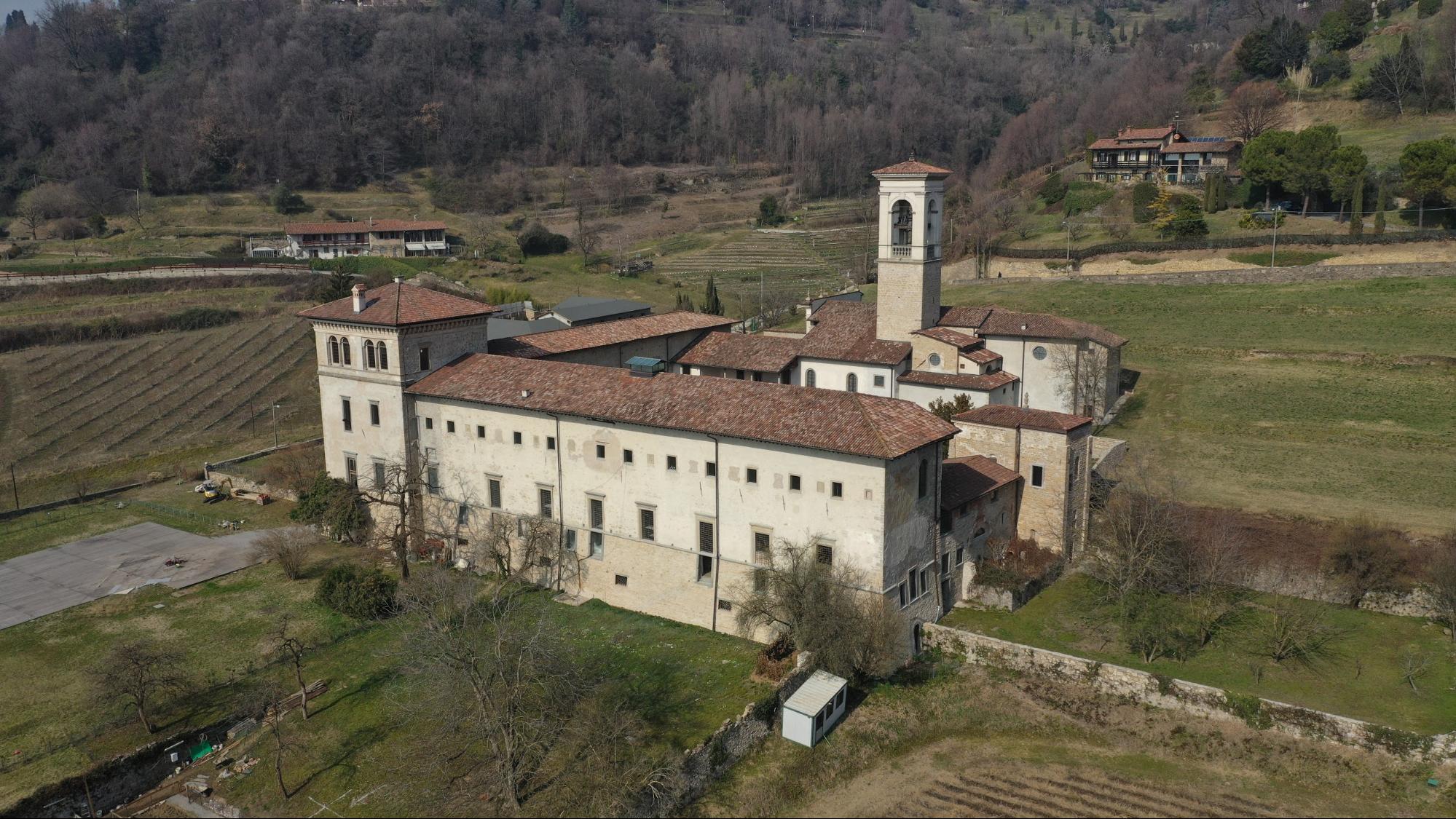
A few months ago, our models were noticed by the municipality of our province, Bergamo, which decided to fund us in order to recreate a digital version of every historical and cultural site in our territory. The high definition three-dimensional model of the Monastery was created with the purpose of promoting the digital conservation of historical and cultural heritage. These digital models, thanks to their richness of information and the ease with which they can be consulted and interpreted, are extremely useful for the creation of a digital archive of historical heritage which can be preserved and studied in case they are subjected to any kind of damage due to the time or natural disaster.
Skycrab has already digitally recreated various historical buildings and medieval villages, such as the Monastero Benedettino di valmarina (BG) and Borgo di Pagliari (BG), for this conservation and promotion project.
Methodology
To obtain the images necessary for the elaboration of such models, we have utilized a small and powerful drone from DJI, the Mavic 2 Pro. Even with its small dimension (just 900 g) this quadcopter mounts a 1-inch sensor camera with 20 megapixels, allowing us to obtain high quality pictures. Because of the complexity of the structure the drone was flown manually to collect the data of the prospects and the inside yard. For the overall area and the top of the building we planned an automated flight with the DJI app GS pro. In order to obtain the best results possible, we set the overlap of the images between 70% and 85%, based on the complexity of the area photographed. The most difficult part turned out to be the arcade where we had to keep a very high overlap in order to reconstruct the whole pillar. For such a complex building we had to collect almost a thousand pictures.
To generate a metrically correct model, we also collected 15 points with a Total Station and 9 points with a GNSS station.
Once we had collected the data, we uploaded the images in the workstation to start processing it. To generate the 3D model, we used the software Metashape, from the Russian company Agisoft. Our general workflow involves a first check of the quality of the images, using the quality image estimating tool of the software. In case of low-quality photos, if possible, we collect new pictures as soon as possible to ensure that the light conditions have not changed too much. Light is a very important condition to monitor during long campaigns of image collection because different shadow movement might affect the efficiency of the software during the alignment process.
Having checked the quality of the data, the next step is to align the images in order to recreate a sparse cloud, followed by the generation of a dense cloud and mesh. Once we have generated the 3D model, we overlay the points obtained with the total station and GNSS station onto the images. Then, we perform the model optimization, generating a new georectified point cloud from which we create a correct model.
Before uploading the model into Sketchfab, we typically import it into Meshlab where we improve the quality of the model by cleaning all the imperfections present and refining the triangle structure.
Once we have completed all these steps, we are finally ready to upload our model into Sketchfab. Before publishing it, we have optimized the position of the model, corrected the lights and shadows on the model and then verified the texture parameter for the best visualization.
Looking ahead
We are pleased to contribute to this project to create a digital archive of the historical and artistic heritage of our territory. Considering also the sad recent event that happened to Notre Dame, we believe that promoting the digital conservation of such buildings is of extreme importance.


